Tyler’s Top Five Tips for Temps!
Guest Blog Post by Tyler Wallin, New Mexico State University. All images are courtesy of Mr. Wallin.
Water temperature affects all biological, chemical, and behavioral processes for fishes and is a critical variable to consider when managing fish habitat. However, accurately measuring water temperature in a given habitat is more challenging than it sounds, because temperature changes radically across space and time.
In order to overcome these challenges, scientists create stream temperature monitoring networks using temperature loggers (Figure 1).
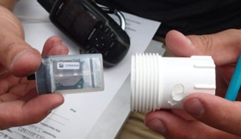
Figure 1: Example of a temperature logger (L), and its protective PVC housing (R).
The loggers are affordable, portable, and continuously log data, so scientists can install lots of them over a large area and track changes in temperature over time (the network). In collaboration with the United States Forest Service (USFS), I installed a stream temperature-monitoring network in the headwaters of the Gila River, New Mexico, in order to learn which streams provide the best habitat for the endangered Gila Trout (Figure 2).
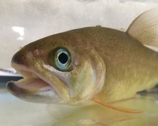
Figure 2: Gila Trout, Oncorhychus gila at Mora National Fish Hatchery, Mora, NM
The Gila River basin includes most of the Gila and Aldo Leopold National Wildernesses. These areas are remote, unforgiving, and undeveloped. Creating the network in such a remote area required traversing hundreds of miles by foot or by mule and learning to expect the unexpected. Headwaters are dynamic habitats—on several occasions I made the 30-mile journey only to discover that the stream channel had shifted several meters and my logger was missing or buried in the mud. Here are five lessons I’ve learned from my experiences with stream temperature monitoring:
5) Air Temperature – Understanding the air to water temperature relationship makes modeling using air temperature predictions possible. Also, a matching air and water temperature at the same time means one of two things, your air logger has been flooded, or more likely, your water logger has emerged from the water and the creek has run dry (Figure 3).
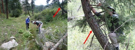
Figure 3: Placing an air temperature logger in the tree near a water temperature logger in an intermittent stream.
4) Find The Perfect Spot – Try to place loggers somewhere protected. Downstream of large, semi-permanent structures works well to protect your logger from instream debris. You also want to consider depth and likelihood of the stream running dry as well. Instream debris may also settle and bury your logger if there is not enough water velocity (Figure 4).
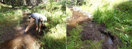
Figure 4: Logger placement in 2016 & Logger retrieval in 2018: can you find it?
Try as you might, no spot is perfect. I have tried to shelter loggers behind Volkswagen-sized boulders and returned to find not only my logger, but also the giant rock missing (Figure 5). Finding the best available spot is sometimes the only option.
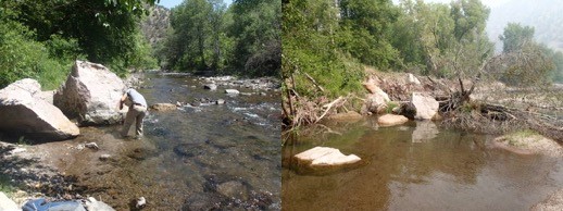
Figure 5: West Fork Gila Logger June 2016 (L) and June 2017 (R). Notice the large boulder I was driving the stake behind in 2016, and the same boulder in the middle of the river in 2017.
3) Take Notes & Pictures – Take notes about where you parked, what trail you took, or other tidbits of information that you wish you had known before. The more pictures you take of the logger site, the better (Figure 6). They are the only way to find some loggers after the GPS says you are within 10 m of its location. When someone else tries to retrieve this logger after a year, they will appreciate the details.
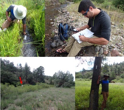
Figure 6: Hand drawn maps, field notes, and lots of pictures make finding a very small logger inside of this thicket of vegetation slightly less challenging.
2) Take a Buddy – Hiking to remote locations is always more fun and safer when you use the buddy system (Figure 7). Plus, who is going to take all of those pictures of you pointing at the logger! More eyes on the stream when it comes time to find loggers covered in a year’s worth of algae are always appreciated as well.
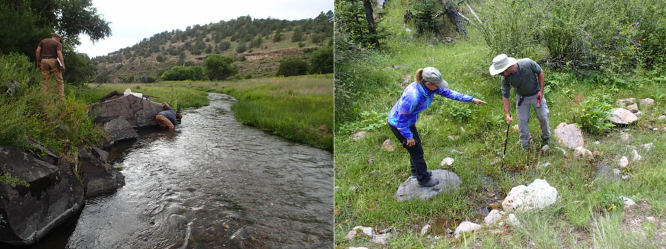
Figure 7: A guide and my advisor often helped by taking photos, packing gear, and by helping search for loggers throughout this project.
1) Don’t give up – Hiking 10 miles through thorn bushes and heat and not finding a logger is disheartening, but with every failure you also learn. Take a spare logger to deploy in these instances and know that wherever you put it before is not a good place. Although challenging at times, the data you do retrieve makes every trip worthwhile. The data scientists obtain through a temperature monitoring network allows for better management. With enough of these data, streams are better managed, fisheries are better preserved, and stakeholders are better served.

